-
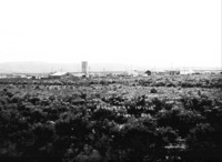
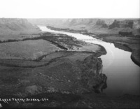 PC-2269
 "Blue Lakes Farm;" Perrine Ranch area of the Snake River canyon, from the rim, showing the first Perrine Bridge.
-
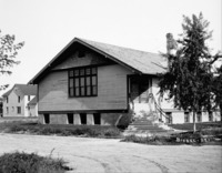 PC-2268
 The First Christian Church of Twin Falls, with long flight of stairs to entry. {Other denominations that used the building included the Immanuel Lutheran Church, Grace Baptist Church, Gospel Temple Church, and Reformed Church,}
-
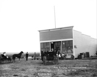 PC-2267
 "The Store at Amsterdam. August 17th, 1912;" a wood frame general store with two buggies, with horses, and several people standing in front of and next to building.
-
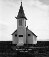 PC-2266
 "Amsterdam Church;" plain wood church with tall steeple.
-
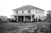 PC-2265
 "The Hotel at Amsterdam;" square wooden frame building, with several people posing near porch in the front. Outbuildings in background.
-
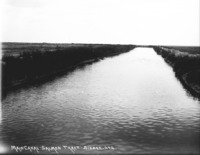
 PC-2264
 "Salmon River Irrigation;" an automobile (car) traverses a bridge over a full canal; several buildings in background
-
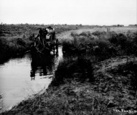 PC-2263
 "The Ford;" stagecoach stopped to give the horses a drink while fording a stream, with a woman and two men in the box seat.
-
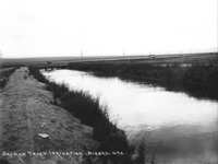
 PC-2262
 "Main Canal - Salmon Tract;" canal filled with water
-
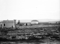 PC-2261
 "Amsterdam, Idaho. August 17th, 1912;" view of the Amsterdam townsite with people; people stand next to the Holland Realty and Investment Co. building in the foreground and the Hotel in the background.
-
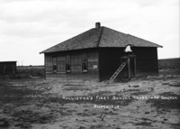 PC-2260
 "Hollister's First School House and Church;" a one-story wooden frame building. A bell on a platform is at the rear, with a ladder leading to the top. A smaller outbuilding is on left.
-
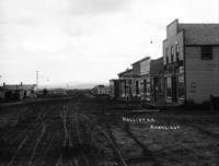 PC-2259
 "Hollister;" buildings along the main street; Businesess and buildings visible include: restaurant, hotel, furniture, general store, general merchandise.
-
 PC-2258
 "At Amsterdam;" wide view of Amsterdam, showing the Salmon River Lumber Company, and a few other buildings.
-
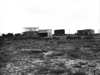
 PC-2257
 "Hollister in 1912;" wide view of early Hollister across a sage brush plain, showing several buildings.
-
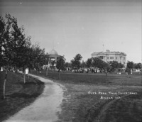 PC-2256
 "City Park, Twin Falls, Idaho;" many people gathered near the band stand (gazebo); County Court House in the background.
-
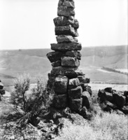 PC-2255
 "The Bryan Monument;" tall pile of rocks (cairn) on the edge of the canyon overlooking the Perrine Ranch. {Was built while William Jennings Bryan was visiting Perrine while campaigning for President.}